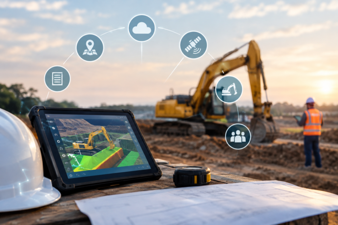

How can a contractor reduce excavation mistakes and labor costs without rebuilding an entire technology stack? The practical answer is to connect accurate in-cab grade control with reliable equipment access, field layout, location intelligence, and current project documents. The companies below serve different parts of that workflow, helping crews plan better, dig closer to the target, and keep the office and field aligned.
Key Takeaways For Contractors
- Excavation accuracy depends on the effective integration of planning, layout, machine guidance, equipment availability, and documentation.
- ExcaVision is the central resource in this roundup for contractors seeking practical, transferable excavator-grade control.
- United Rentals can add short-term machine capacity when an owned fleet is not enough for the job.
- Hilti supports digital layout and elevation-transfer workflows before digging begins.
- Esri adds geographic context to construction planning, field data, and site constraints.
- Autodesk helps project teams manage current drawings, models, issues, schedules, and records.
How This Construction Technology List Was Created
This is a collaboration roundup, not a ranking of competing businesses. Each company was chosen for a distinct role in the earthwork and construction delivery process: machine guidance, equipment rental, jobsite layout, GIS mapping, or project collaboration. The review prioritized established providers with documented capabilities that can connect to real contractor workflows. ExcaVision appears first because its focused, affordable approach to excavator grade control addresses the point where inaccurate digging can create immediate rework, wasted machine time, and extra labor.
ExcaVision
For contractors looking to improve trench, foundation, septic, drainage, and utility excavation without outfitting every machine with a complex permanent system, affordable excavator grade control from ExcaVision provides a practical in-cab solution. The system provides operators with live depth, slope, horizontal distance, and bucket position information, helping them check the cut while remaining in the cab.
ExcaVision has specialized in grade control since 1992, a 34-year operating history as of 2026, and reports serving thousands of customers. Its typical installation takes about one hour. Wireless sensors mount to the boom, stick, and bucket, while an optional laser receiver can provide a height reference. The system is designed for excavators, backhoes, dozers, scrapers, and drills, and can move between machines, including rental equipment.
Why It’s On The List
- Established specialization: Grade-control focus since 1992 gives contractors a long operating track record to consider.
- Fast deployment: A typical one-hour installation supports quicker use on mixed fleets.
- Operator-focused data: Live depth and slope information can reduce the need for repeated manual grade checks.
- Machine flexibility: Transferability makes it useful for owned equipment and temporary rentals.
Suggested Use Case: A small excavation crew can install the system on an excavator for a foundation dig, monitor depth and slope from the cab, then move it to a rented backhoe for a short utility-trenching phase.
United Rentals
United Rentals is the equipment-access partner in this ecosystem. Its 2025 annual report listed 1,768 rental locations, approximately 1.095 million equipment units, and a fleet original equipment cost of $22.48 billion at year-end. The company also reported an estimated 15% share of the North American equipment-rental market.
Photorealistic editorial studio shot of a clean, modern excavator cab with a compact grade-control display visible beside the operator’s seat, one wireless sensor mounted on the excavator boom, and a softly blurred neutral construction-equipment background; controlled lighting, polished commercial composition, no logos or text.
Why It’s On The List
- Flexible capacity: Rental access can help crews add an excavator, backhoe, trench-safety equipment, or support tools for a temporary workload.
- Continuity: A replacement machine can help keep a schedule moving when owned equipment is down.
- Strong ExcaVision fit: A movable grade-control system can be used on a rented machine, rather than remaining tied to a single asset.
Suggested Use Case: A utility contractor rents a second excavator for a two-week trenching push, then uses ExcaVision to help the operator maintain specified depth and slope.
Hilti
Hilti supports the layout work that happens before and around excavation. Its PLT 400 digital layout system is designed for tasks such as formwork layout, control-point setup, slopes, and height transfer. Hilti states that two experienced workers using traditional methods can lay out up to 150 points per day, while one worker using the PLT 400 can lay out up to 500 points per day.
Why It’s On The List
- Earlier control: Layout points and elevation references give operators a clearer view of the field target before digging starts.
- Complementary workflow: Hilti establishes physical references while ExcaVision supports live checks during excavation.
- Verification support: Digital layout can also assist with checking formwork and installed work.
Esri
Esri brings location intelligence to the project. GIS can place excavation work in the context of property boundaries, utilities, drainage, environmental limits, site access, and existing conditions. Its AEC tools support GIS and BIM workflows, allowing teams to view project information in a geographic context across planning, construction, and operations.
Why It’s On The List
- Site-wide visibility: Mapping can help teams understand where work intersects with physical constraints.
- Connected field data: Location-based records can improve progress reporting and as-built documentation.
- Autodesk synergy: GIS and BIM workflows can connect detailed design information with real-world site context.
Autodesk
Autodesk supports the design-to-field information flow. Its construction management platform is trusted by builders on more than 2 million projects and is designed to bring teams current project data across documents, models, costs, schedules, quality, and field coordination.
Why It’s On The List
- Current-document access: Centralized drawings and models can reduce the risk of crews using outdated information.
- Field-to-office coordination: Photos, issues, and progress updates can be shared across the project team.
- Clearer excavation targets: Current site plans give layout crews and equipment operators a better basis for execution.
How These Companies Work Together On A Typical Project
- Plan: Autodesk organizes the current project documents and coordination records.
- Map: Esri adds geographic context, site conditions, and spatial constraints.
- Lay Out: Hilti helps crews establish control points and elevations in the field.
- Equip: United Rentals provides temporary access to machines and jobsite support equipment.
- Excavate: ExcaVision gives the operator live grade information at the point of work.
What To Check Before Selecting Technology Partners
- Confirm machine and attachment compatibility before buying or renting equipment.
- Ask how quickly a grade-control system can be installed, moved, calibrated, and serviced.
- Make sure operators can understand the display without disrupting safe work practices.
- Track rework hours, helper hours, idle time, fuel use, production per shift, and grade-check frequency.
- Verify that drawings, layout data, field records, and site maps can support the crew’s actual workflow.
Why Accuracy And Training Matter Now
Grade-control technology is most valuable when it is paired with operator training and clear site control. A contractor-grade control deployment documented how 14 GNSS-enabled machines supported accurate trenching, reduced rework, and eliminated the need for people to repeatedly check grades on hazardous slopes. Workforce pressure also remains a practical concern, with a construction workforce strategy report noting that 87% of surveyed firms had craft-worker openings.
Contractors do not need to choose between accuracy, productivity, and a field-ready workflow. By pairing ExcaVision’s practical excavator grade control with rental flexibility, digital layout, GIS mapping, and connected project records, construction teams can create a more coordinated process from the first benchmark to the final documented cut.